- Titulinis
- Dalykinė ir mokslinė literatūra
- Fiziniai ir gamtos mokslai
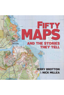
- Fifty Maps and the Stories they Tell
Fifty Maps and the Stories they Tell
Balsavo 0
ISBN: 9781851245239
Leidimo metai: 2019
Puslapių skaičius: 144
Formatas: Minkšti viršeliai
Formatas: 19.6×19.6
Leidimo metai: 2019
Puslapių skaičius: 144
Formatas: Minkšti viršeliai
Formatas: 19.6×19.6
Kaina:
Šių parametrų produkto neturime
Likutis pakankamas
Iš leidyklos gausime per 3-5 savaitės. Galimas vėlavimas
Turime sandėlyje. Pristatymas Lietuvoje 1-4 d.d.
Iš leidyklos gausime per 3-5 savaitės. Galimas vėlavimas
Pristatymo sąlygos
Aprašymas
From medieval maps to digital cartograms, this book features highlights from the Bodleian Library's extraordinary map collection together with rare artefacts and some stunning examples from twenty-first-century map-makers. Each map is accompanied by a narrative revealing the story behind how it came to be made and the significance of what it shows. The chronological arrangement highlights how cartography has evolved over the centuries and how it reflects political and social change. Showcasing a twelfth-century Arabic map of the Mediterranean, highly decorated portolan charts, military maps, trade maps, a Siberian sealskin map, maps of heaven and hell, C. S. Lewis's map of Narnia, J. R. R. Tolkien's cosmology of Middle-earth and Grayson Perry's tapestry map, this book is a treasure-trove of cartographical delights spanning over a thousand years.
Atsiliepimai (0)
Palikite atsiliepimą

